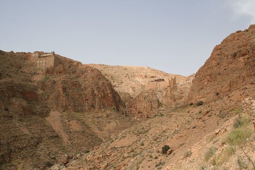
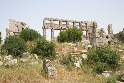
Some cool christian travel sites images:
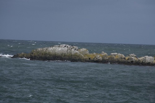
DALKEY, SOUTH DUBLIN
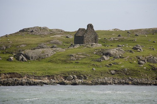
Image by infomatique
Dalkey Island is situated about 10 miles south of Dublin, near the village of Dalkey, two miles south of Dún Laoghaire harbour. The island is now uninhabited by humans, but there are the remains of houses, a church and a Martello Tower. Located less than 300 metres offshore the island comprises 9 hectares (22 acres).
Dalkey Island, only 5 minutes by local boat from Coliemore Harbour, is an important site of ancient and historic remains. Artefacts from the island, now housed in the National Museum in Dublin, are evidence that the original occupants were from the Mesolithic or Middle Stone Age. Settlers continued to use the site through the Iron Age and Early Christian period.
There is evidence it was inhabited in the 4th millennium BC (6000 years ago) and was also used as a Viking base. There are ruins of another church, dating from the 7th century, named after St Begnet. This was altered on the east side when builders used it as living quarters while building the nearby Martello tower and gun battery in 1804. An older wooden church was probably here before the present stone one was built.
A promontory fort was located at the northern end of the island, its presence still visible today in the form of a ditch. A herd of goats, originally put there in the early 1800s, remains there today but they are replacements of the original goats which were removed.
You can take a boat to the island in the summer months, by asking one of the local fishermen at Coliemore or Bulloch Harbour. The island is also an ideal spot for fishing, with Pollock, Coalfish, Wrasse and Mackerel being caught.
The ruined stone church was built in the 9th/10th Century and was probably abandoned when the Vikings used the island as a base to form part of the busiest port in the country at that time. In the early 19th Century the British Admiralty erected the Martello Tower, one of eight dotted along the Dun Laoghaire coastline, as an early warning defensive device against the one time threat of invasion during the Napoleonic era.
The channel between the island and the mainland is very deep and was once considered as a location for an oil terminal. However, the local area is very residential, and it was decided that the terminal should go elsewhere.
The waters around Dalkey Island are much used for sailing, angling and diving. Rocks known as Maiden or Carraig Rock, Clare Rock and Lamb Island all to the northwest form part of the ridge of the Island. Parts of these rocks are only visible at low tide.
The Rocks to the east of the Island are known as "The Muglins" and are a different group or chain. These form a danger to shipping and have been fitted with a distinctive beacon.
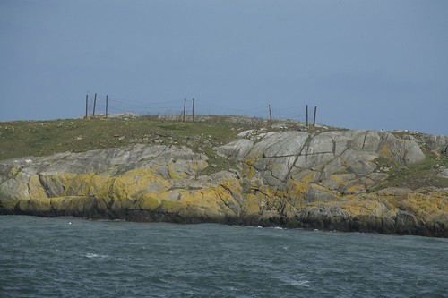
DALKEY, SOUTH DUBLIN
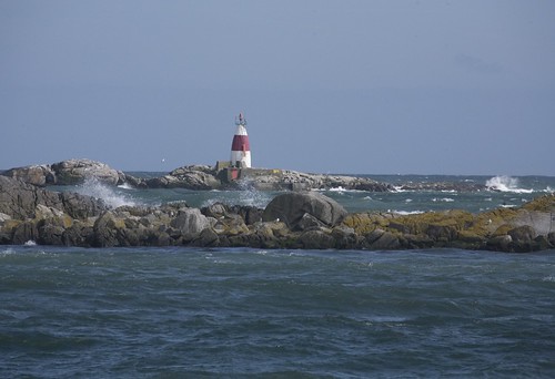
Image by infomatique
Dalkey Island is situated about 10 miles south of Dublin, near the village of Dalkey, two miles south of Dún Laoghaire harbour. The island is now uninhabited by humans, but there are the remains of houses, a church and a Martello Tower. Located less than 300 metres offshore the island comprises 9 hectares (22 acres).
Dalkey Island, only 5 minutes by local boat from Coliemore Harbour, is an important site of ancient and historic remains. Artefacts from the island, now housed in the National Museum in Dublin, are evidence that the original occupants were from the Mesolithic or Middle Stone Age. Settlers continued to use the site through the Iron Age and Early Christian period.
There is evidence it was inhabited in the 4th millennium BC (6000 years ago) and was also used as a Viking base. There are ruins of another church, dating from the 7th century, named after St Begnet. This was altered on the east side when builders used it as living quarters while building the nearby Martello tower and gun battery in 1804. An older wooden church was probably here before the present stone one was built.
A promontory fort was located at the northern end of the island, its presence still visible today in the form of a ditch. A herd of goats, originally put there in the early 1800s, remains there today but they are replacements of the original goats which were removed.
You can take a boat to the island in the summer months, by asking one of the local fishermen at Coliemore or Bulloch Harbour. The island is also an ideal spot for fishing, with Pollock, Coalfish, Wrasse and Mackerel being caught.
The ruined stone church was built in the 9th/10th Century and was probably abandoned when the Vikings used the island as a base to form part of the busiest port in the country at that time. In the early 19th Century the British Admiralty erected the Martello Tower, one of eight dotted along the Dun Laoghaire coastline, as an early warning defensive device against the one time threat of invasion during the Napoleonic era.
The channel between the island and the mainland is very deep and was once considered as a location for an oil terminal. However, the local area is very residential, and it was decided that the terminal should go elsewhere.
The waters around Dalkey Island are much used for sailing, angling and diving. Rocks known as Maiden or Carraig Rock, Clare Rock and Lamb Island all to the northwest form part of the ridge of the Island. Parts of these rocks are only visible at low tide.
The Rocks to the east of the Island are known as "The Muglins" and are a different group or chain. These form a danger to shipping and have been fitted with a distinctive beacon.
Coordinates: 53°16?N 6°05?W
DALKEY, SOUTH DUBLIN
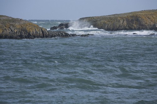
Image by infomatique
Dalkey Island is situated about 10 miles south of Dublin, near the village of Dalkey, two miles south of Dún Laoghaire harbour. The island is now uninhabited by humans, but there are the remains of houses, a church and a Martello Tower. Located less than 300 metres offshore the island comprises 9 hectares (22 acres).
Dalkey Island, only 5 minutes by local boat from Coliemore Harbour, is an important site of ancient and historic remains. Artefacts from the island, now housed in the National Museum in Dublin, are evidence that the original occupants were from the Mesolithic or Middle Stone Age. Settlers continued to use the site through the Iron Age and Early Christian period.
There is evidence it was inhabited in the 4th millennium BC (6000 years ago) and was also used as a Viking base. There are ruins of another church, dating from the 7th century, named after St Begnet. This was altered on the east side when builders used it as living quarters while building the nearby Martello tower and gun battery in 1804. An older wooden church was probably here before the present stone one was built.
A promontory fort was located at the northern end of the island, its presence still visible today in the form of a ditch. A herd of goats, originally put there in the early 1800s, remains there today but they are replacements of the original goats which were removed.
You can take a boat to the island in the summer months, by asking one of the local fishermen at Coliemore or Bulloch Harbour. The island is also an ideal spot for fishing, with Pollock, Coalfish, Wrasse and Mackerel being caught.
The ruined stone church was built in the 9th/10th Century and was probably abandoned when the Vikings used the island as a base to form part of the busiest port in the country at that time. In the early 19th Century the British Admiralty erected the Martello Tower, one of eight dotted along the Dun Laoghaire coastline, as an early warning defensive device against the one time threat of invasion during the Napoleonic era.
The channel between the island and the mainland is very deep and was once considered as a location for an oil terminal. However, the local area is very residential, and it was decided that the terminal should go elsewhere.
The waters around Dalkey Island are much used for sailing, angling and diving. Rocks known as Maiden or Carraig Rock, Clare Rock and Lamb Island all to the northwest form part of the ridge of the Island. Parts of these rocks are only visible at low tide.
The Rocks to the east of the Island are known as "The Muglins" and are a different group or chain. These form a danger to shipping and have been fitted with a distinctive beacon.
Coordinates: 53°16?N 6°05?W